
PFAS fate and transport
Watershed-scale PFAS modeling
Simulating PFAS across a whole drainage basin — soil, runoff, the vadose zone, the aquifer and the stream — inside one mass balance, from national data.
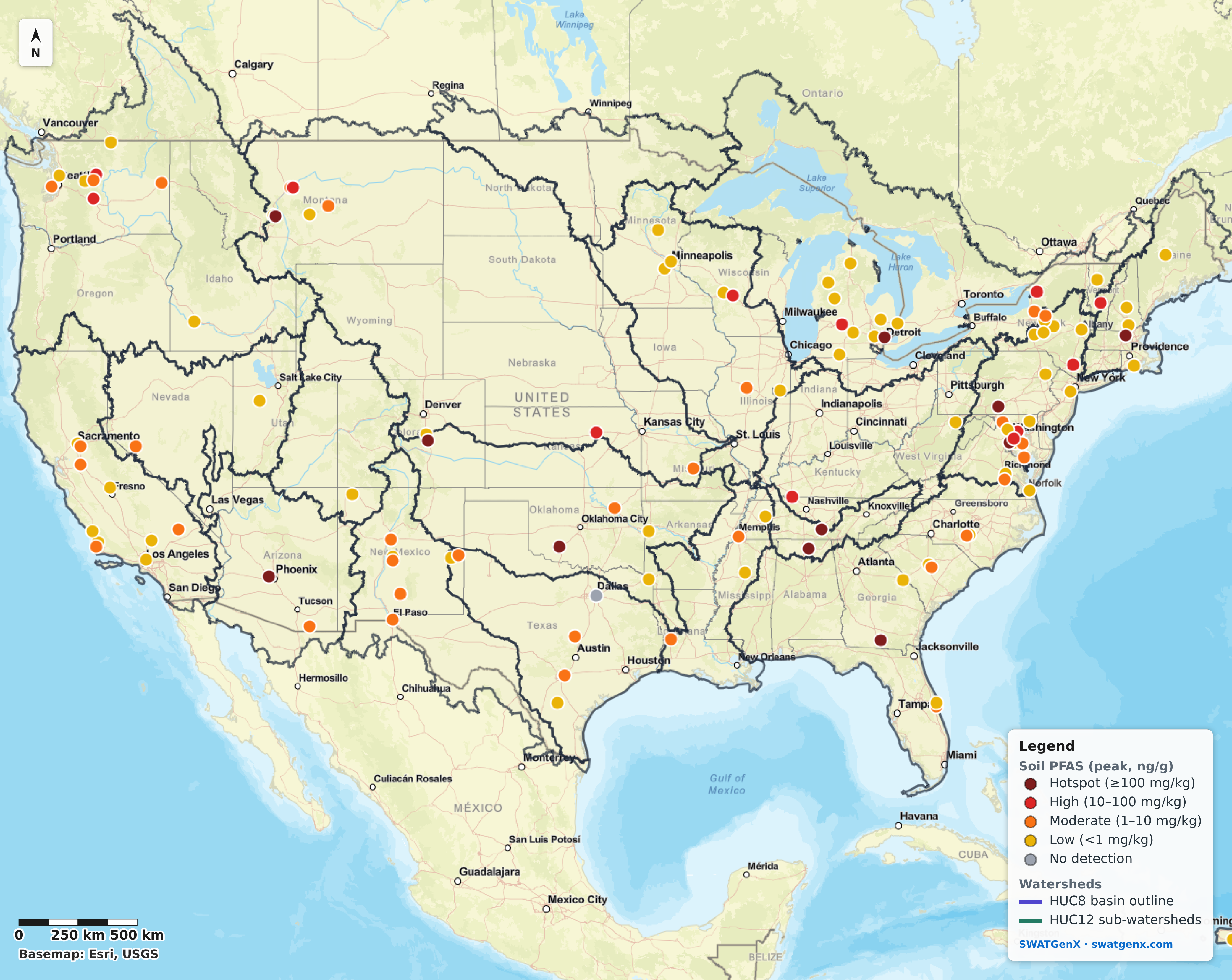
What watershed-scale PFAS modeling is
Watershed-scale PFAS modeling simulates PFAS across an entire drainage basin rather than at a single site: where it enters the landscape, how much of it moves, and where it accumulates or discharges. Because the model resolves every catchment in the basin, PFAS can be carried from soil through runoff, the vadose zone, groundwater and streams inside one mass balance — instead of any one of those being a boundary condition someone supplies by hand.
That is a different question from the one a site model answers. A site model resolves a single source area at a few metres and is the right tool for remediation design; it needs inflow and groundwater boundary conditions, and those come from the watershed. The watershed scale is where you can ask which sources dominate loading to a river, how much PFAS leaves a basin, and where receptors sit relative to all of the sources rather than one of them.
Where this category came from
Watershed-scale PFAS modeling is a young field, and it has a traceable starting point. SWATGenX’s founder published one of its founding studies — Rafiei & Nejadhashemi (2023), Water Research 240:120073 — which built a distributed, watershed-scale PFAS fate-and-transport model and remains among the most-cited entries for the topic. This platform is the engineering generation of that work: the same modeling idea, automated from national datasets so that a basin can be built in hours rather than assembled by hand.
Watershed-scale PFAS modeling: common questions
What is watershed-scale PFAS modeling?
Watershed-scale PFAS modeling simulates PFAS across an entire drainage basin rather than at a single site: where it enters the landscape, how much of it moves, and where it accumulates or discharges. A watershed-scale model resolves every catchment in the basin, so it can carry PFAS from soil through runoff, the vadose zone, groundwater and streams within one mass balance, instead of treating any one of those as a boundary condition supplied by hand.
How is it different from site-scale PFAS modeling?
Site-scale models resolve a single source area — a fire-training area, a landfill, a wellfield — at a few metres, and are the right tool for remediation design. They need inflow and groundwater boundary conditions from somewhere, and those come from the watershed. Watershed-scale modeling supplies that context and answers the questions a site model cannot: which sources dominate loading to a river, how much PFAS leaves a basin, and where receptors sit relative to all of the sources rather than one of them.
Can standard SWAT+ simulate PFAS fate and transport?
No. Out-of-the-box SWAT+ simulates only nitrogen, phosphorus, and legacy pesticides — it has no PFAS routines, and its groundwater is a simplified one-dimensional store that cannot carry a three-dimensional plume. PFAS fate and transport in SWATGenX runs on the platform’s own modified SWAT+ engine, built and validated in-house: PFAS-specific soil sorption (Freundlich), vadose-zone retardation, and coupled MODFLOW 6 GWT aquifer transport.
What data does a watershed-scale PFAS model need?
Hydrography, terrain, soils, land cover and climate to build the watershed; a source term to put PFAS into it; and observations to evaluate it against. SWATGenX assembles the first group automatically from national datasets for any catchment in the conterminous United States, and supplies the second and third from open inventories it maintains — measured soil concentrations and a national PFAS monitoring inventory. Site-specific boring logs and monitoring-well data then refine a model rather than being a prerequisite to start one.
Is SWATGenX affiliated with a university or government agency?
No. SWATGenX is an independent, self-funded company. Its modified SWAT+ engine, the PFAS fate-and-transport capability, and the SWAT+/MODFLOW 6 coupling were conceived, engineered, and validated in-house, with no university or government agency funding or involvement.