
Site-scale PFAS modeling
AFFF site PFAS groundwater modeling
From the foam on the ground to the receptor downgradient — soil, vadose zone and aquifer simulated together, with the surrounding watershed supplying the boundaries.
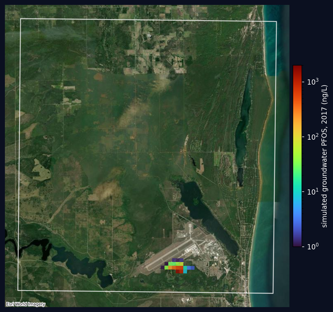
What AFFF site groundwater modeling is
AFFF site groundwater modeling simulates how PFAS released from aqueous film-forming foam — typically at a fire-training area, a hangar, or a crash site — moves from the soil where it was applied, down through the vadose zone, into the aquifer, and toward receptors such as drinking-water wells or a stream.
It is asked for three reasons, and they want different things from the same model. Receptor risk asks who is affected and when, so the arrival time matters more than the peak. Remediation design asks where to intercept the plume, so the geometry and the hydraulic response to pumping matter most. Source verification asks whether an observed detection is even consistent with a given release — a question a model can answer in the negative, by showing that no admissible source strength reproduces what was measured.
What you need to start
The site boundary and suspected release areas; a soil source term, ideally measured with depth rather than an assumed flux; aquifer geometry and hydraulic properties; and monitoring data to evaluate against. SWATGenX supplies national defaults for the hydrogeology and the regional water balance, and maintains an open inventory of measured soil PFAS concentrations that can seed the source term. Site-specific boring logs, static water levels and monitoring-well concentrations then refine the model — they sharpen the answer rather than being a prerequisite to begin. AFFF and defense-associated facilities are one of the four categories in the platform's potential-source map, which marks where PFAS may have been used or released and not sites where contamination has been confirmed.
AFFF site modeling: common questions
What is AFFF site groundwater modeling?
AFFF site groundwater modeling simulates how PFAS released from aqueous film-forming foam — typically at a fire-training area, hangar, or crash site — moves from the soil where it was applied, down through the vadose zone, into the aquifer, and toward receptors such as drinking-water wells or a stream. It answers three practical questions: which receptors are at risk and when, where a remedy should be placed to intercept the plume, and whether an observed detection is consistent with a given source.
Why does the vadose zone matter so much at AFFF sites?
Because most of the delay lives there. PFAS released decades ago at the surface may still be in transit through unsaturated soil, held up by sorption and by adsorption at air–water interfaces that does not occur once the material is below the water table. A model that starts at the water table implicitly assumes that transit already happened, which can put the arrival of a plume decades out of place. Explicit vadose-zone transport is the difference between a source term and a guess.
What data do I need to model an AFFF site?
At minimum: the site boundary and the suspected release areas; a soil source term, ideally measured concentrations with depth rather than an assumed flux; aquifer geometry and hydraulic properties; and monitoring-well data to evaluate against. SWATGenX supplies national defaults for the hydrogeology and the regional water balance, and maintains an open inventory of measured soil PFAS concentrations that can seed the source term. Site-specific boring logs, static water levels and monitoring-well concentrations then refine the model — they sharpen the answer rather than being a prerequisite to begin.
How does a site model relate to the surrounding watershed?
A site model needs boundary conditions — how much water arrives, and what the groundwater is doing at the edges of the domain. Those come from the watershed. SWATGenX builds the watershed model at 250 m and rebuilds the single catchment holding the site at 30 m, nested inside it, so the boundary conditions are simulated rather than assumed. That nesting is a shipped capability, demonstrated at Wurtsmith AFB in Michigan.
Is SWATGenX affiliated with a university or government agency?
No. SWATGenX is an independent, self-funded company. Its modified SWAT+ engine, the PFAS fate-and-transport capability, and the SWAT+/MODFLOW 6 coupling were conceived, engineered, and validated in-house, with no university or government agency funding or involvement.