Oregon SWAT+ modeling
Hurricane Creek (USGS 13329500), in the Wallowa basin: documented SWAT+ USGS station model snapshot with Explorer-aligned maps.
Case study basin: Wallowa
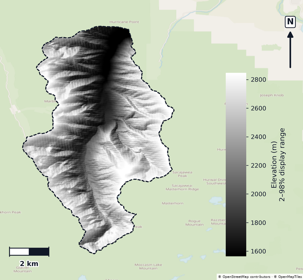
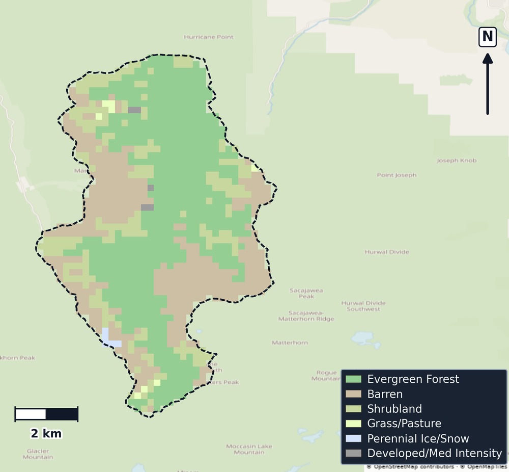
Below is a documented SWAT+ model-build snapshot for the Wallowa watershed—the same export class as Watershed Explorer. The metric strip, maps, charts, NHD flowline-length summary by feature class, and fact tables follow from that committed export.
The metric strip, fact tables, and optional DEM/CDL maps describe the exported SWAT+ workspace for Wallowa (HUC8 17060105). NHD-linked stream statistics and PRISM climate headers follow the same conventions as other SWATGenX state sample models across CONUS.
Counties in the basin overlay: Wallowa.
- Runoff timing and climate variability across multi-year forcing
- Channel routing and NHDPlus HR hydrography linkage
- Land cover and HRU discretization for management screening
- Reproducible SWAT+ package delivery via SWATGenX
Basin distributions (Wallowa · Oregon)
CDL charts use the same basin-clipped raster summary as Explorer watershed reports. County population bars use US Census county-or-equivalent polygons only (not state, city, or township layers): one published headcount per county that intersects the basin, then summed for screening—not watershed-apportioned density.
CDL land cover (basin clip)
CDL cropland & permanent crops (share)
Population by county (overlay)
Land-cover mix (km², CDL clip)
Climate forcing (Wallowa · Oregon)
Monthly climatology from basin PRISM precipitation and temperature, and NSRDB humidity and solar radiation files. The line is the mean daily value for each calendar month (averaged across all station files and years); the shaded band is the P05–P95 spread of those daily values (2000-01-01 – 2024-12-31). 12 weather grid cells (4 km) used by the model: PRISM precipitation and temperature, NSRDB humidity and solar radiation, gridMET wind.
Precipitation
mm day⁻¹ (PRISM)Relative humidity
% (NSRDB)Solar radiation
MJ m⁻² day⁻¹ (NSRDB)Daily maximum temperature
°C max (PRISM)Daily minimum temperature
°C min (PRISM)Key facts
The first table lists basin id, climate window, CDL and population context, and the two published stream-length definitions (channel routing versus NHD-linked stream GIS). The strip above still carries headline structure counts (HRUs, channels, lakes).
| Metric | Value |
|---|---|
| WBD HU8 name | Wallowa |
| USGS gauge | 13329500 |
| WBD region (VPUID) | 1706 |
| Model domain | 76.75 km² |
| USGS-reported drainage area (NWIS site record) | 76.66 km² |
| SWAT+ stream GIS segments (NHDPlusID → NHDFlowline) | 526 |
| Stream length — channel routing (rivs1, projected) | 233.32 km |
| NHD-linked stream length, GIS projected | 235.46 km |
| DEM resolution (m) | 29.99 |
| CDL cropland (basin clip) | 0.01 km² |
| CDL wetland (Woody + Herbaceous) | 0.35 km² |
| CDL developed | 0.34 km² |
| Population (by county, Explorer overlay) | 7,391 |
| Counties (gov. units) | 1 |
| Climate period (PRISM header) | 2000-01-01 – 2024-12-31 |
| Stats exported (UTC) | 2026-11-14 05:24 UTC |
| SWATGenX snapshot ID | 1706/usgs_station/13329500 |
| Snapshot label | Wallowa (Oregon) — usgs_station |
| Model statistics generated (UTC) | 2026-11-14T05:24:05Z |
How to read this table: each row starts from Watershed/Shapes/SWAT_plus_streams.shp, where each segment carries NHDPlusID. Those IDs join to NHDFlowline in the USGS NHDPlus HR HU4 geodatabase (VPUID 1706). Lengths add in EPSG:5070 (planimetric km) and roll up by NHD FType / FCode. Row lengths sum to 235.46 km over 526 segments.
| NHD class (label) | Length (km) | Share | Segments |
|---|---|---|---|
| Stream / river (intermittent)FType 460 · FCode 46003 | 170.09 | 72.2% | 304 |
| Stream / river (perennial / general)FType 460 · FCode 46006 | 62.33 | 26.5% | 188 |
| Artificial path (NHD)FType 558 · FCode 55800 | 3.04 | 1.3% | 34 |
The county total matches the bar chart: county-or-equivalent units only (cities and townships excluded), one Census headcount per county intersecting the basin. Screening context only—not basin density or a regulatory design population.
Documented SWATGenX SWAT+ package for Oregon (1706/usgs_station/13329500). Screening and documentation only—not a regulatory determination.
What SWATGenX generates
SWATGenX assembles national inputs, runs the QSWAT+ / SWAT+ Editor workflow, and exports a reviewable SWAT+ workspace (TxtInOut + GIS + SQLite). Open the package in SWAT+ Editor for scenarios; add calibration and validation with local data where your study requires it.
National datasets (labels)
This sample build uses NHDPlus HR at 1:24k, 30 m terrain (from 10 m 3DEP), 250 m NLCD land use (from 30 m), 250 m gSSURGO soils (from 30 m), ~4 km PRISM weather, and daily NSRDB values at the same 4 km grid cells (from ~4 km, 30-minute data). See SWAT+ model packages by state for the full stack. Methodology & provenance.
Citations for on-page facts
- Hydrologic catalog: USGS WBD — USGS station 13329500 (HUC12-located SWAT+ model)
- Hydrography: USGS NHDPlus HR — each SWAT+ stream segment (``NHDPlusID``) joined to HU4 ``NHDFlowline`` (FType/FCode); lengths summed in EPSG:5070 for the distribution table.
- Land cover (CDL): USDA NASS Cropland Data Layer (clipped to basin)
- Climate forcing: PRISM Climate Group (OSU), daily met files referenced in weather-sta.cli
- Regional population context: USGS Census county-or-equivalent polygons (GU_CountyOrEquivalent) clipped to the basin — one headcount per county, summed for screening (not basin-apportioned density; cities and townships excluded).
SWAT+ in Oregon — common questions
- How do I run SWAT+ in Oregon? Use SWATGenX to screen basins in Oregon on the Watershed Explorer map, then queue a SWAT+ model build for a USGS gage, catalog HUC12, or HUC8. The platform assembles national datasets into a SWAT+ Editor package without manual QSWAT+ desktop prep for each basin. The sample model on this page is the Hurricane Creek watershed above USGS 13329500, in the Wallowa basin.
- What is the difference between SWAT and SWAT+ in Oregon? SWAT (legacy) and SWAT+ (current process-based watershed model) both support long-term hydrology and water-quality studies in Oregon. SWATGenX targets SWAT+ and delivers reproducible, high-resolution projects on NHDPlus HR hydrography.
- Can SWATGenX build SWAT+ models for Oregon watersheds? Yes. SWATGenX covers CONUS, including Oregon, with the same national data stack (WBD, NHDPlus HR, PRISM, NLCD, gSSURGO). Each state page documents a sample basin snapshot from a real SWATGenX build; open the live map at https://www.swatgenx.com/watershed-workspace to model your own watershed.
- How do I get a SWAT+ model for Oregon on SWATGenX, and what does it cost? Agencies ask us for a study of a watershed in Oregon, quoted for that watershed: request a proposal at https://www.swatgenx.com/work-with-us. Research groups that build SWAT+ models for Oregon themselves work with us by invitation: request access at https://www.swatgenx.com/signup.
Open Wallowa in Watershed Explorer
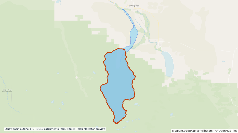
Preview uses the USGS WBD boundary with NHDPlus HR context, zoomed to basin extent on a Streets-style basemap. Follow the card into the live workspace (HUC8 17060105).