
SWATGenXSWATGenX
Watershed ExplorerPricing
ServicesWatershed ExplorerExample modelsCloud calibrationDocsPricing

Texas

Trinity River Basin
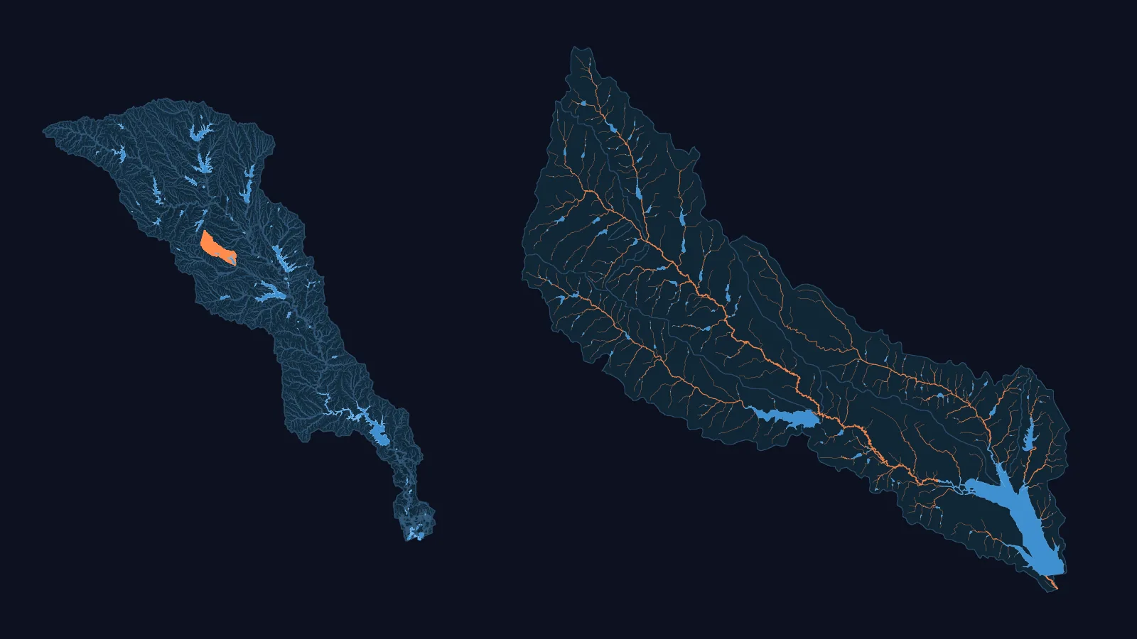
Left: the Trinity basin (WBD HUC4 1203) with its NHDPlus HR network, its larger lakes and reservoirs, and our Chambers model (USGS 08063800) in orange. Right: that model drawn large, every one of its channels, with its water bodies in blue.
Left: the Trinity basin, with our Chambers model (USGS 08063800) in orange and its larger lakes and reservoirs in blue. Right: that model drawn large, its channels in orange and its water bodies in blue.
  • 1 published SWAT+ model
  • NHDPlus HR: 75,081 km of network flow paths in its Texas HUC8s, 2.88x NHDPlus V2.1's 26,055 km
  • 62 USGS gauges with a 90 % daily record, 2014-2024, in its Texas HUC8s (12 of 12 HUC8s covered)
  • 12 HUC8s mostly in Texas, 46,386.7 km² in all (WBD HUC12 sum)

Basin: HUC4 1203 (Trinity) of the USGS Watershed Boundary Dataset.

Basin name: TWDB Major River Basins (2014). TWDB: 'These are not the official TWDB basin boundaries.'

Our models in this basin

Chambers · USGS 08063800 (Waxahachie Creek near Bardwell)

NHDPlus HR, not Version 2, in this basin

020,00040,00060,00080,000100,000020,00040,00060,00080,000100,000NHDPlus Version 2.1, kmNHDPlus HR, kmLower CanadianNorth CanadianRed HeadwatersRed-Washita River BasinRed-SulphurSabineNeches River BasinGalveston Bay-San JacintoBrazos HeadwatersMiddle BrazosLower BrazosUpper ColoradoLower Colorado-San Bernard CoastalCentral Texas CoastalNueces-Southwestern Texas CoastalRio Grande-AmistadRio Grande Closed BasinsLower PecosRio Grande-FalconTrinity River BasinTrinity River Basin
Each point is one basin (WBD HUC4), over its HUC8s that lie mostly in Texas: its network flow paths in NHDPlus Version 2.1 (across) and in NHDPlus HR (up), filled with canals and ditches in both counts, hollow without them. On the line, the two would be equal. Ringed: the two datasets' areas for this basin differ by more than 5 %: Galveston Bay-San Jacinto, Brazos Headwaters, Lower Brazos, Upper Colorado, Lower Colorado-San Bernard Coastal, Central Texas Coastal, Rio Grande Closed Basins, Lower Pecos and Rio Grande-Falcon. In this figure, this basin's points are orange.

A model of your Texas watershed

We build a SWAT+ model for a USGS stream gauge in Texas, from national data. You download it as files you open in SWAT+ Editor and run, and you keep the files.