Wyoming SWAT+ modeling
Upper Tongue — USGS 06307500: documented SWAT+ USGS station watershed snapshot with Explorer-aligned maps.
Case study basin: Upper Tongue
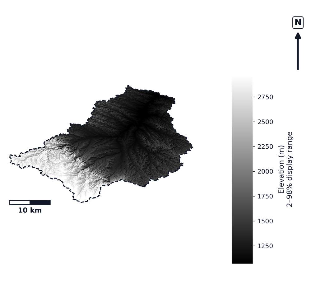
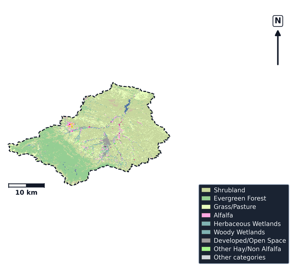
Below is a documented SWAT+ model-build snapshot for the Upper Tongue watershed—the same export class as Watershed Explorer. The metric strip, maps, charts, NHD flowline-length summary by feature class, and fact tables follow from that committed export.
The metric strip, fact tables, and optional DEM/CDL maps describe the exported SWAT+ workspace for Upper Tongue (HUC8 10090101). NHD-linked stream statistics and PRISM climate headers follow the same conventions as other SWATGenX state sample models across CONUS.
Counties in the basin overlay: Big Horn, Montana, Big Horn, Wyoming, Johnson, Wyoming, Rosebud, Montana, Sheridan, Wyoming.
- Runoff timing and climate variability across multi-year forcing
- Channel routing and NHDPlus HR hydrography linkage
- Land cover and HRU discretization for management screening
- Reproducible SWAT+ package delivery via SWATGenX
Basin distributions (Upper Tongue · Wyoming)
CDL charts use the same basin-clipped raster summary as Explorer watershed reports. County population bars use US Census county-or-equivalent polygons only (not state, city, or township layers): one published headcount per county that intersects the basin, then summed for screening—not watershed-apportioned density.
CDL land cover (basin clip)
CDL cropland & permanent crops (share)
Population by county (overlay)
Land-cover mix (km², CDL clip)
Key facts
The first table lists basin id, climate window, CDL and population context, and the two published stream-length definitions (channel routing versus NHD-linked stream GIS). The strip above still carries headline structure counts (HRUs, channels, lakes).
| Metric | Value |
|---|---|
| WBD HU8 name | Upper Tongue |
| USGS site (HUC12 model folder) | 06307500 |
| WBD region (VPUID) | 1009 |
| Model domain | 4862.95 km² |
| USGS-reported drainage area (NWIS site record) | 4620.54 km² |
| SWAT+ stream GIS segments (NHDPlusID → NHDFlowline) | 15490 |
| Stream length — channel routing (rivs1, projected) | 8525.39 km |
| NHD-linked stream length, GIS projected | 8783.26 km |
| DEM resolution (m) | 29.98 |
| CDL cropland (basin clip) | 161.31 km² |
| CDL wetland (Woody + Herbaceous) | 149.31 km² |
| CDL developed | 111.12 km² |
| Population (by county, Explorer overlay) | 72,342 |
| Counties (gov. units) | 5 |
| Climate period (PRISM header) | 2000-01-01 – 2024-12-31 |
| USGS streamflow CSV series (workspace) | 39 |
| Stats exported (UTC) | 2026-10-08 02:19 UTC |
| SWATGenX snapshot ID | 1009/usgs_station/06307500 |
| Snapshot label | Upper Tongue (Wyoming) — usgs_station |
| Model statistics generated (UTC) | 2026-10-08T02:19:00Z |
How to read this table: each row starts from Watershed/Shapes/SWAT_plus_streams.shp, where each segment carries NHDPlusID. Those IDs join to NHDFlowline in the USGS NHDPlus HR HU4 geodatabase (VPUID 1009). Lengths add in EPSG:5070 (planimetric km) and roll up by NHD FType / FCode. Row lengths sum to 8,783.26 km over 15,490 segments.
| NHD class (label) | Length (km) | Share | Segments |
|---|---|---|---|
| Stream / river (intermittent)FType 460 · FCode 46003 | 6,184.96 | 70.4% | 8,524 |
| Stream / river (perennial / general)FType 460 · FCode 46006 | 1,399.15 | 15.9% | 2,180 |
| Stream / river (FCode 46007)FType 460 · FCode 46007 | 587.77 | 6.7% | 1,591 |
| Artificial path (NHD)FType 558 · FCode 55800 | 471.22 | 5.4% | 3,078 |
| Canal / ditchFType 336 · FCode 33600 | 136.03 | 1.5% | 113 |
| Stream / riverFType 460 · FCode 46000 | 3.91 | 0% | 1 |
| ConnectorFType 334 · FCode 33400 | 0.22 | 0% | 3 |
The county total matches the bar chart: county-or-equivalent units only (cities and townships excluded), one Census headcount per county intersecting the basin. Screening context only—not basin density or a regulatory design population.
Documented SWATGenX SWAT+ package for Wyoming (1009/usgs_station/06307500). Screening and documentation only—not a regulatory determination.
What SWATGenX generates
SWATGenX assembles national inputs, runs the QSWAT+ / SWAT+ Editor workflow, and exports a reviewable SWAT+ workspace (TxtInOut + GIS + SQLite). Open the package in SWAT+ Editor for scenarios; add calibration and validation with local data where your study requires it.
National datasets (labels)
This sample build uses the same CONUS resolutions as every SWATGenX package—NHDPlus HR at 1:24k, 30 m terrain (from 10 m 3DEP), 250 m NLCD/CDL (from 30 m), 250 m gSSURGO (from 10 m), ~4 km PRISM, and daily NSRDB at PRISM stations (from ~2 km, 30-minute data). See SWAT+ model packages by state for the full stack. Methodology & provenance.
Citations for on-page facts
- Hydrologic catalog: USGS WBD — USGS station 06307500 (HUC12-located SWAT+ model)
- Hydrography: USGS NHDPlus HR — each SWAT+ stream segment (``NHDPlusID``) joined to HU4 ``NHDFlowline`` (FType/FCode); lengths summed in EPSG:5070 for the distribution table.
- Land cover (CDL): USDA NASS Cropland Data Layer (clipped to basin)
- Climate forcing: PRISM Climate Group (OSU), daily met files referenced in weather-sta.cli
- Regional population context: USGS Census county-or-equivalent polygons (GU_CountyOrEquivalent) clipped to the basin — one headcount per county, summed for screening (not basin-apportioned density; cities and townships excluded).
SWAT+ in Wyoming — common questions
- How do I run SWAT+ in Wyoming? Use SWATGenX to screen basins in Wyoming on the Watershed Explorer map, then queue a SWAT+ model build for a USGS gage, catalog HUC12, or HUC8. The platform assembles national datasets into a SWAT+ Editor package without manual QSWAT+ desktop prep for each basin. The sample model on this page is Upper Tongue (USGS 06307500).
- What is the difference between SWAT and SWAT+ in Wyoming? SWAT (legacy) and SWAT+ (current process-based watershed model) both support long-term hydrology and water-quality studies in Wyoming. SWATGenX targets SWAT+ and delivers reproducible, high-resolution projects on NHDPlus HR hydrography.
- Can SWATGenX build SWAT+ models for Wyoming watersheds? Yes. SWATGenX covers CONUS, including Wyoming, with the same national data stack (WBD, NHDPlus HR, PRISM, NLCD, gSSURGO). Each state page documents a sample basin snapshot from a real SWATGenX build; open the live map at https://www.swatgenx.com/watershed-workspace to model your own watershed.
- How do I get a SWAT+ model for Wyoming on SWATGenX, and what does it cost? Create a SWATGenX account to build SWAT+ models for Wyoming: an account starts with three models. The MAX and Department plans add larger builds and MODFLOW 6 coupling, and cloud calibration is on every plan, paid from calibration credit; prices for every plan are listed at https://www.swatgenx.com/pricing.
Open Upper Tongue in Watershed Explorer
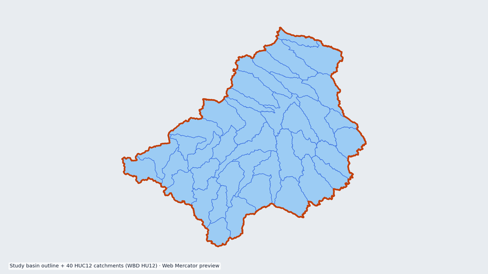
Preview uses the USGS WBD boundary with NHDPlus HR context, zoomed to basin extent on a Streets-style basemap. Follow the card into the live workspace (HUC8 10090101).